
How Does GPS Tracking Work? A Clear 2026 Guide
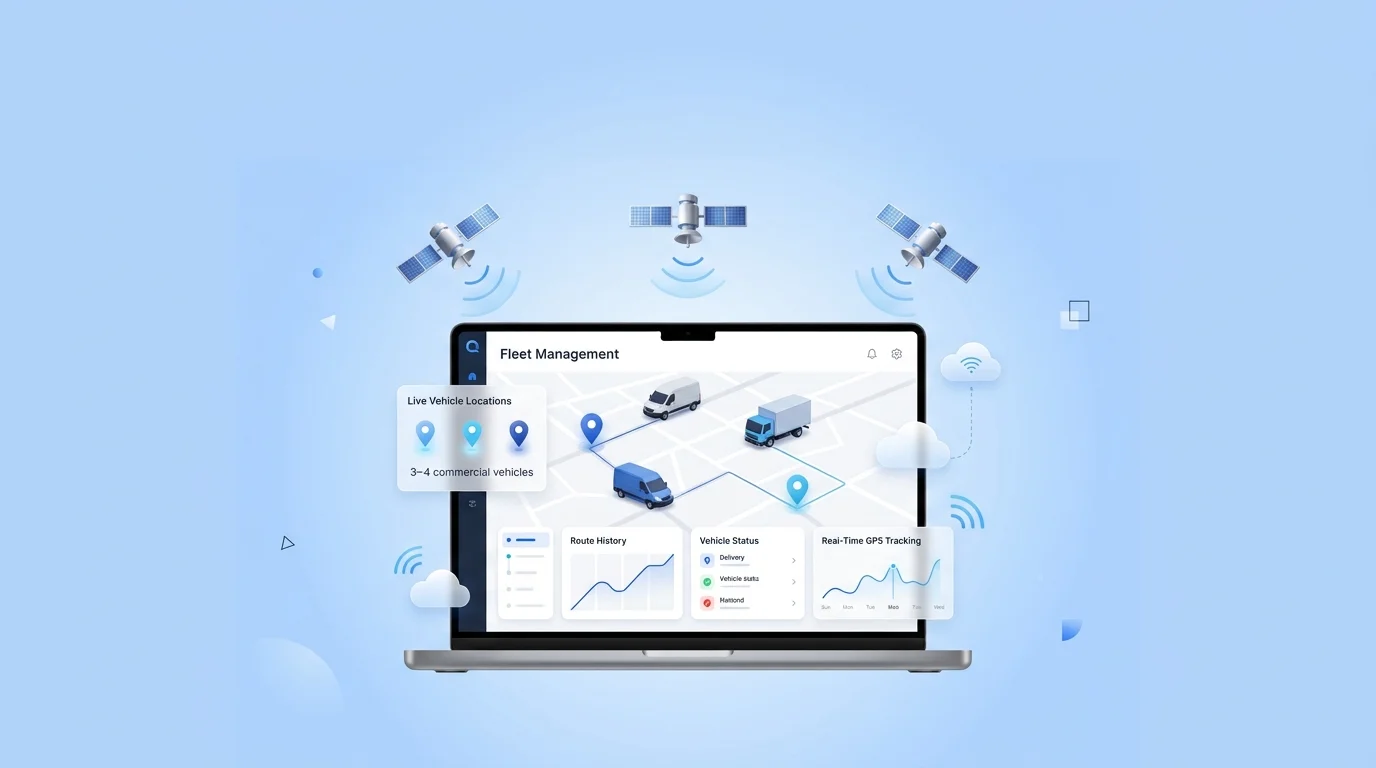
There are four steps to GPS tracking. A GPS device uses a network of satellites to receive signals from, and a calculation called trilateration to determine its exact location. Then sends the location to a server via a cellular network (4G/5G). The software on that server then plots the location on a map and converts the raw data into trips, alerts and reports. In short: satellites find the device, the cellular connection transmits the data and software makes it meaningful.
Key Takeaways
- All four components, satellites, the tracking device, a cellular network and software, are necessary to enable GPS tracking.
- The device determines its position by trilateration, which is the distance from at least 4 satellites.
- The location information does not broadcast directly to your screen, but has to be sent via cellular networks to a server.
- Software transforms raw coordinates into live maps, trip history, geofences and reports.
- It is typically to a few metres, but may be limited by buildings, tunnels and terrain.
This guide explains each in simple terms, and then discusses accuracy and types of tracking. self-hosted vs cloud GPS tracking. essentially, where the data resides after you get it to the server.
The Four Parts of a GPS Tracking System
How GPS tracking works: GNSS satellites transmit signals to a GPS receiver which uses trilateration to determine the receiver’s location, which is then passed through the cellular network to a server and into tracking software.
When one hears about GPS tracking, they usually think of the dot moving across the map but that dot is the end of the chain and the chain has four links. If any one is missing, the system does not operate.
| Component | Job | Example |
| Satellites (GNSS) | Broadcast timing signals from orbit | GPS, GLONASS, Galileo, BeiDou |
| GPS tracking device | Receives signals, calculates position | Vehicle tracker, asset tag, phone |
| Cellular network | Carries location data to the server | 4G LTE, 5G, NB-IoT |
| Tracking software | Turns data into maps and reports | Fleet tracking platform |
Satellites and the device deal with positioning. The network and the software is responsible for the meaning and delivery. Knowing how to divide is key, how to know the whole system.
Step by Step: How Location Is Calculated
Here’s what happens between a satellite in orbit and the live map on your screen.
- Satellites broadcast signals. Satellites and the device deal with positioning. The network and the software is responsible for the meaning and delivery. Knowing how to divide is key, how to know the whole system.
- The device receives them. The GPS tracker records signals from more than one satellite and calculates the time it took each one to reach the GPS tracker.
- It calculates distance. The travel time directly translates to distance from each satellite because the signals are known to move at a specific speed.
- Trilateration fixes the position. It determines latitude, longitude, altitude and time from the distances it measures with at least four satellites.
- The data is transmitted. That position is transmitted over the cellular network to a server by the device.
- Software makes it useful. The platform displays the location and records points to trips and activates alerts/reports.
The first four steps occur within the device, in seconds. It’s the last two that make a tracking platform worthwhile.
What Is Trilateration?
The maths behind the map is called “trilateration”. It determines a location based on distances to known locations and satellites in this instance.
Suppose you are exactly 12,000 km from one satellite; you might be anywhere on a large ball around the satellite. If a second satellite is added, then the two spheres overlap in a circle. With a third, it reduces it to two. With a third, it reduces it to two. The fourth one confirms the exact location and corrects the device’s clock. Hence, GPS demands a minimum of four signals from satellites for an accurate fix.
GNSS vs GPS: What’s the Difference?
It’s like the two terms have become synonymous, but there’s a difference.
GPS (Global Positioning System) is the satellite system of the USA, consisting of about 30 satellites.
All of them are collectively known as GNSS (Global Navigation Satellite System) and are referred to as the US GPS, the Russian GLONASS, Europe’s Galileo and China’s BeiDou.
Why it’s important in practice: A GPS-only receiver reads one constellation; a GNSS receiver reads multiple constellations, which equates to more satellites in view, quicker fixes, and better accuracy in difficult environments, such as cities and canyons. Most modern trackers can also receive GNSS signals, even if they are marketed as GPS trackers.
How the Data Reaches You
One of the misconceptions is that your tracker identifies your location directly to your phone. It doesn’t. The device determines its location using satellite signals and then transmits that data, via a cell phone link, to a server. That server is the one you log in to and use the software.
If a car passes through a tunnel or a dead zone, the device continues to compute position, but will not be able to upload it until it reconnects with the vehicle, which usually occurs when it resumes contact with the vehicle, uploading the stored points. That’s also one reason why the choice of where the server is located is a very real one: on a vendor’s cloud or your own infrastructure. That is what self-hosted vs cloud GPS tracking,is all about and one of the main reasons why some businesses opt to own their tracking platform outright.
What Affects GPS Tracking Accuracy?
While modern GPS tracking typically has a range of accuracy of a few meters, there are several factors in the real world that increase the margin of error:
- Line of sight to the sky. The fixes are best in open areas, but are prevented or reflected by dense cities, tunnels and indoor spaces.
- Number of satellites in view. A tighter fix with more satellites (with the help of multi-constellation GNSS support).
- Signal reflection.The position can be thrown off by the “multipath” of tall buildings.
- Atmospheric conditions. Small delays can occur in the ionosphere and in the atmosphere due to the weather.
- Device quality and update rate. A cleaner track is achieved by a better antenna and more frequent pings.
The quality and refresh rate of the device. A cleaner track is achieved by a better antenna and more frequent pings. Most fleet tracking requirements don’t demand a centimeter level of accuracy, but for precision work, there are correction services, such as RTK, that can improve it from meters to centimeters.
What Are the Types of GPS Tracking?
Not all tracking is the same. The two broad categories:
- Real-time (active) tracking. The gadget transmits position on a regular basis, so you get real-time movement. This is the basis of fleet, logistics and field teams depend on.
- Passive (logger) tracking. No live feed as data is stored for subsequent retrieval. Useful in analyzing routes afterwards.
Tracking is then applied to vehicles, assets & equipment or people/field staff with device form factor. For those considering a system, our roundup of the best GPS fleet tracking systems then goes through the options and what is fleet tracking software covers the software side.
Where AIQConnect Fits
All of the above is common to all GPS trackers in the world; none of the vendors own that physics. The only real difference between platforms is the final link, the software, and more importantly, the software’s location and who owns the data.
Most systems operate that software on their own cloud and charge a monthly fee for each vehicle. The other path is taken by AIQConnect: the same tracking software, but with no impact on the server infrastructure, and all locations data generated by your devices remain yours and remains self-contained. That ownership model is the determining one for a business that has sensitive movement data or a reseller that would like to have his/her own platform. Not for all people, a very small fleet that require no setup at all may turn to plug-and-play cloud, but for those who value data ownership and predictable cost, it is a great choice.
To go deeper, see the benefits of self-hosted GPS tracking software or compare models in self-hosted vs cloud GPS tracking.
Frequently Asked Questions
How does GPS tracking work in simple terms?
The location of a GPS device is determined by sending signals from satellites and performing a process called ‘trilateration’. It then uploads this address via a cellular network to a server that software uses to display the location on a map and transform it into trips, alerts and reports.
How many satellites does GPS tracking need?
At least four. Three can set a rough position, a fourth is necessary to verify a position accurately to correct the internal clock. The faster and more accurate fixes are with devices that can see more satellites, particularly multi-constellation GNSS devices.
What is the difference between GPS and GNSS?
GPS is a satellite network specifically of the United States. The all-encompassing term for all the big networks — GPS, GLONASS, Galileo and BeiDou — is GNSS. A GNSS receiver is based on multiple GNSS signals, providing a higher accuracy than GPS only.
How does a GPS tracker send its location?
Don’t share your location directly with your phone. The device determines its location by using satellites and shares this information via a cellular network (4G/5G) with a server. You then see it in the tracking software.
How accurate is GPS tracking?
In general within a few meters in the open. Signals are lost or bounced by tall buildings, in tunnels or indoors, robbing accuracy. Specialized uses can achieve centimeter accuracy with correction services such as RTK.
Does GPS tracking work without cellular signal?
Once it reconnects it can send the satellite calculated position but in the meantime it can calculate its position without cellular. Most of the trackers store a point or two of location when there is no signal, and upload them when signal comes back.
What is trilateration in GPS?
GPS works by measuring distances to several satellites: this is called trilateration. It is often mistakenly thought of as triangulation, but triangulation measures angle, trilateration measures distance.


